Preliminary point check
Drop a point on the map and see which zones intersect it and which procedures they usually involve, before you file an application.
Android · unofficial app
Aviation zones, aerodromes, parks, heritage sites and active NOTAMs, in one answer for a point on the map.
Not on Google Play yet: the button starts the tester sign-up.
Unofficial app. The developer does not represent the Government of the Republic of Korea and is not affiliated with any government agency. The app does not grant flight permissions.
The app answers the question “which zones and procedures apply to this point”, not the question of permission.
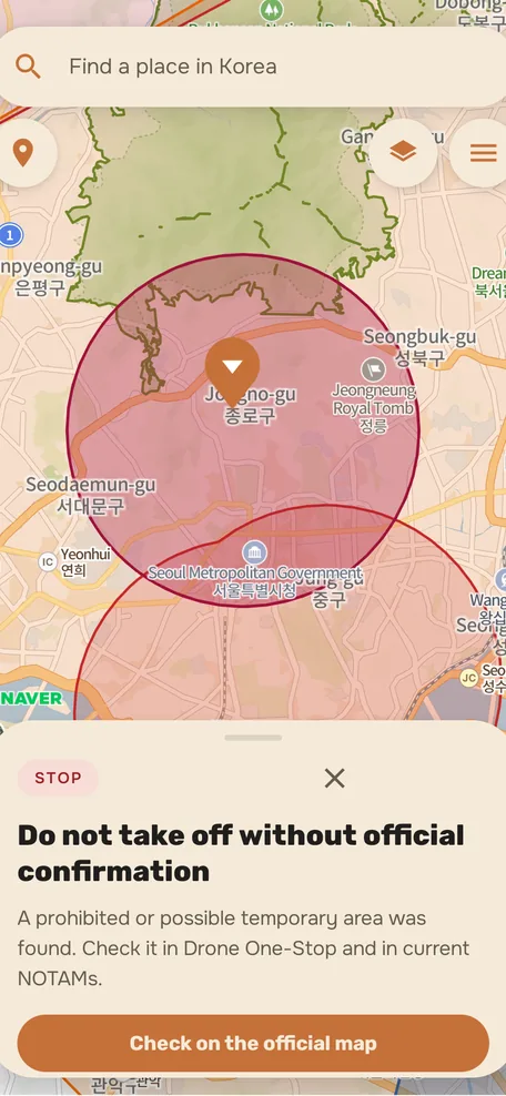
Drop a point on the map and see which zones intersect it and which procedures they usually involve, before you file an application.
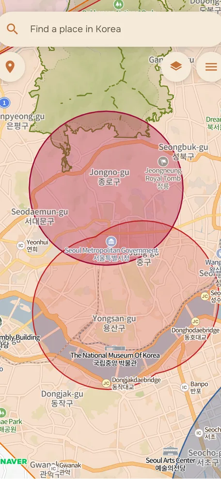
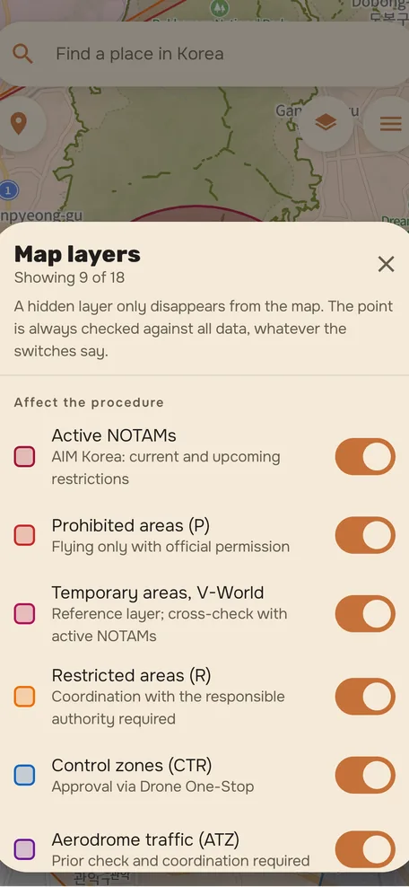
Prohibited (P), restricted (R), control zones (CTR), aerodrome traffic zones (ATZ), parks, heritage sites. A hidden layer disappears only from the map: the point is still checked against all data.
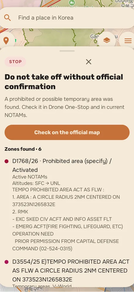
Current and upcoming restrictions from AIM Korea, with the original message text, altitudes and validity period.
Palaces, tombs, temples and their protection perimeters as a separate layer, because filming near them follows its own procedure.
Drone mass, altitude, time of day, VLOS or BVLOS, filming. Shows what applies to your case: 비행승인, 항공촬영, category 4종.
English, Russian and 한국어. Korean procedure names are never translated: that is how the authority refers to them.
App screen captures. These are images, not a working map.
Sources, licenses and the snapshot date. The data is a snapshot taken on the stated date, not a live feed from the authority.
| Source | What we take | License or basis | Snapshot date |
|---|---|---|---|
| 국토교통부 / V-World | Aviation zones, aerodromes, national parks, cultural heritage sites | KOGL Type 1 | updated daily |
| AIM Korea | Active and upcoming NOTAMs | Aeronautical information publication | updated every 10 minutes |
| OpenStreetMap | Place search and auxiliary geography | ODbL 1.0, © OpenStreetMap contributors | live requests |
| NAVER map | Basemap inside the app, place and address search (Local Search, Geocoding) | Official NAVER SDK, terms of service | live SDK basemap |
The full list of third-party materials and license texts is in the license notices.
What the app does not do. This matters more than the feature list: a misunderstood limit costs more here.
Official Drone One-Stop serviceClosed testing
Closed testing is a Google Play mode where the app can be installed only by people on a pre-assembled list. It exists to verify the data and procedures on real routes before publication.
The install link arrives after your address is added to the participant list.
Opens an email to [email protected]. There is no payment and no obligation; you can leave at any time.
The full texts referenced by the app page on Google Play. The privacy policy and the terms of use are available in English; the other documents are currently in Russian.
What data is processed, why and for how long. There are no analytics and no trackers.
dronezone.kr/en/privacy →The terms on which the reference information is provided and where the user's responsibility lies.
dronezone.kr/en/terms →Data sources, libraries and fonts with license texts and attribution.
dronezone.kr/notices →How the drone flight rules in Korea are organized and which procedures are handled where.
dronezone.kr/rules →It depends on the aircraft mass, the place, the altitude, the time of day and whether you film. The app shows which zones the point touches and which procedures they usually involve: 비행승인, 항공촬영 or registration. The decision is made by the authority on a Drone One-Stop application, and only its answer has legal force.
It is one of the categories into which Korea divides drones by maximum take-off mass; each has its own paperwork and operator requirements. The app suggests which category and which procedure most likely apply to your case. The exact conditions are with 국토교통부 and Drone One-Stop.
Because it is a reference tool, not a government service. The developer does not represent the Government of the Republic of Korea and is not affiliated with any government agency. The app answers about zones and procedures; the authority reviews the application.
From AIM Korea publications. The app stores a snapshot and refreshes it on a schedule, showing the original message text, altitudes and validity period. Messages without explicit geometry are not drawn on the map and stay in the list as text.
The point check runs on the device itself: the coordinates of the point and of your location are not sent to our server. The network carries place search queries and the NOTAM and zone snapshot downloads, and the NAVER SDK loads the map for the visible area like any map does. No account is needed, no check history is kept, and there are no analytics or third-party trackers. Details are in the privacy policy.
There is only an Android build for now. There is no iOS timeline, and promising one would be dishonest.
No. There is no offline mode, no flight log, no weather, no notifications and no application filing: it is a reference map and a checklist.